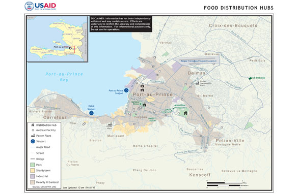
 I thought this was an interesting map because it explains the food distribution hubs in Haiti. It also shows medical facilities, power plants, and seaports located in the Port-au-Prince area. I found this map off of a CNN website. The map has pretty much all the nesscessary map elements other than a North arrow. Overall I feel like its a decent map to get the basics on how many support and medical locations are actually in the zone where the quake hit and some other small details about the area.
Friday, February 12, 2010
Haiti Participation Post Map
I thought this was an interesting map because it explains the food distribution hubs in Haiti. It also shows medical facilities, power plants, and seaports located in the Port-au-Prince area. I found this map off of a CNN website. The map has pretty much all the nesscessary map elements other than a North arrow. Overall I feel like its a decent map to get the basics on how many support and medical locations are actually in the zone where the quake hit and some other small details about the area.
Subscribe to:
Post Comments (Atom)

No comments:
Post a Comment